
This morning we took the Dinghy over to Bitter End Yacht Club and Saba Rock to pick up yacht burgees from each place. We’ve decided to start collecting them from the places we go. As we prepared to leave we were waiting for the fuel dock to clear so we could top off the diesel. There were 3 boats in front of us, so we decided to make for Yacht Harbor on the southern end of Virgin Gorda and refuel there.
I was a little worried about our fuel supply because we had run the engine for several hours on the trip, but based on what Conch’s checkout person said during the briefing, we should have plenty of fuel in reserve. And in a 36 foot boat, I could always sail to the destination, then harness the dinghy up behind the boat to power it into a fuel dock if we ran out at the last minute.
We cleared the North Sound and headed west around the end of the island. The winds had all shifted now, the weather report said they’d come from the southeast, but these were coming from the southwest. The previous day as we sailed around the north end of Virgin Gorda I’d noticed that the winds shifted several times as they came around the hills and different islands, so I hoped the wind would improve. Here is a map of the trip created with my Spot Satellite Messenger. You can turn on labels and zoom in/out to reference the island names.
I assumed I must be in a wind shadow of Virgin Gorda, so I let the sails out a little and decided to head out to Seal Dog Islands before pointing into the wind and heading up to Yacht Harbor. Unfortunately, the wind was straight out of the southwest, coming directly out of Yacht Harbor. This meant a very long day of tacking into the wind, which would be made longer by Virgin Gorda’s wind shadow. Or, a plan B.
I ran down to look at the charts, and decided to make for Marina Cay and Trellis Bay, saving the Baths and Yacht Harbor for another day. Marina Cay was several miles ahead, but I could almost get there on my current point of sail. So we tightened up the sails and ran as upwind as we could.
There were two more boats headed in the same general direction – an Island Packet 40+ and a Moorings charter boat. The charter boat tried tacking upwind too early and showed very poor sail trim. The Island Packet was a private boat, and was skippered flawlessly.
Once we got all the way over to the bay north of Scrub Island, it was time to start tacking upwind to get around to Marina Cay. The Island Packet was two tacks ahead of me, and we’d passed the Moorings boat (a 40 footer) several miles back. The Moorings boat again tacked too early, and floundered a little in the lee of the Dogs.
Just then I thought I remembered there was another entrance to Marina Cay from the North. So I set the autopilot and ran do to look at the charts. One of the cruising guides described the cut between Camanoe and Scrub Island, mentioning that it was possible to motor through. So we decided to head into the bay and over to the cut. This would save us an hour or more of tacking. I was a little worried heading into the bay because I could not see the cut. But soon two boats came in directly from the north and into the cut.
At Deadman’s Point we dropped sails and raised the iron genny. I was a little nervous about seeing the reefs through the cut, because the cruising guide said to do the passage in good visibility. Turned out I had nothing to worry about, the passage was fairly easy to see, and the reefs were clearly visible outside the channel.
When we drop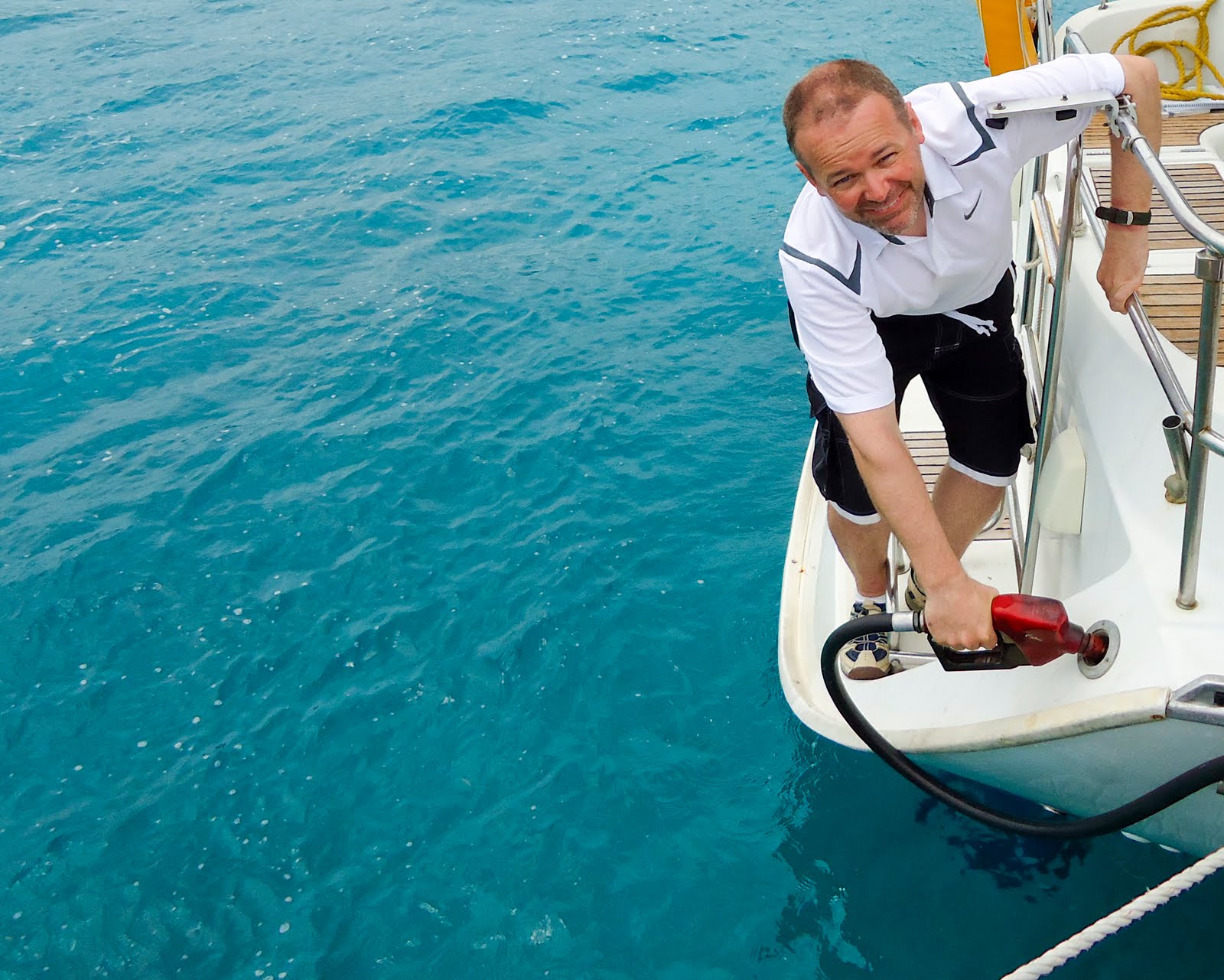 ped sails, we also set the docking lines and fenders for the fuel dock on Marina Cay. Arriving in the mooring field, a boat was just leaving the fuel dock, so we were able to get right in. We’d used 20 gallons of water, and only FIVE gallons of diesel! I was really surprised it was so little diesel. Even around the fueling dock, the water was a gorgeous, translucent blue. After fueling we stood on the dock and looked in the water, seeing straight to the bottom in 15 feet of water. There were dozens of little fish swimming all around.
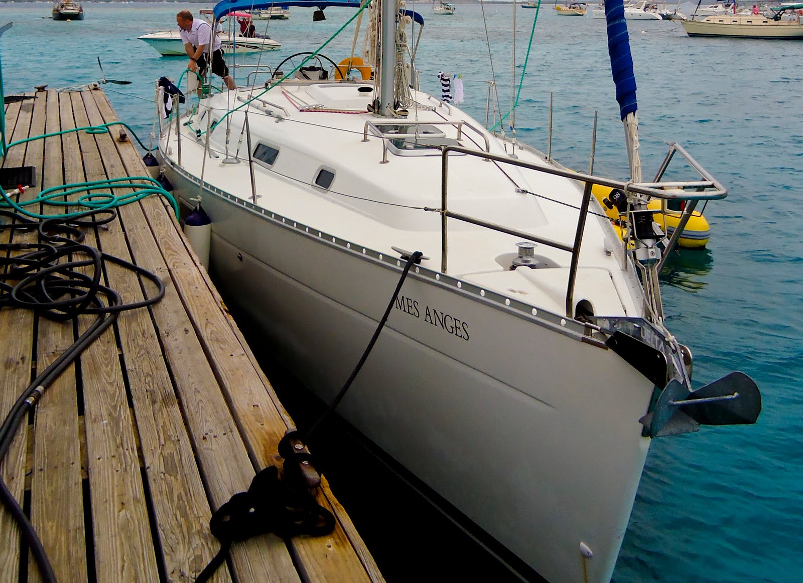
Marina Cay looked like a nice place to stay, but we decided to head over to Trellis Bay because I was worried that the southerly winds might make Marina Cay a little rolly. And I had read about the shops and interesting local culture on the shores at Trellis Bay and wanted to check it out. So we motored across the channel to Trellis Bay.
Trellis Bay is a very peaceful anchorage with many, many moorings around. Several of the boats had ‘For Sale’ signs on them. I always have to remind myself that I do not have enough PTO at work to make a boat down here a worthwhile investment. Well, that and the fact that I can’t afford one. But it feels better to blame it on paltry vacation time.
The sun was out, and the water so clear you could see straight to the bottom in about 12 feet of water. We slipped past the moored boats and found a mooring ball closer to the beach, so we’d have shorter trips in the dinghy. As soon as we were secured, I grabbed my mask and fins and dove overboard for a short snorkeling trip. I was a little disappointed by the amount of trash I saw on the bottom. It was definitely still a marine environment (I chased a puffer fish for a while), and the water was clear, but there were a number of beer cans, etc. on the bottom. Cleaning the bottom of Trellis Bay would be a great Eagle Scout service project.
 We went in to shore and tied up the dinghy at de Loose Mongoose’s dinghy dock. De Loose Mongoose is a beachside bar and restaurant. Great tplace to unwind for the evening. We ate in the screened-in porch of the little restaurant, the food was simple and good. The Mongoose was introduced to the islands to rid it of snakes (good move). We saw several mongoose diving into their tunnels as we walked along the trees by the shore.
 The businesses along the shore of Trellis Bay are not the refined business we saw in other bays. These have a definite local flair and charm to them. Lots of old boats in various states of disrepair were interspersed through the trees. As we passed each one I wondered about the arrival of each on shore. Who owned her? What plans and hopes were tied up in her? And was anyone really crazy enough to take these out on the open water?

 Aragorn, a local artist, has had his hand in so many interesting things along the shores. Giant metal balls that are filled with firewood and lit during the monthly full moon parties, huge brightly colored hammocks that would fit 10 people in them, tables built around and through the trees, and several quaint buildings selling his pottery, painting, and sculptures. There were several dogs and roosters running around, and lots of local kids who belong to the store owners and employees.
Trellis Bay is next to the Beef Island airport, and is within easy walking distance. If I ever had to pick up a guest arriving late, I would have them walk to Trellis Bay from the airport. What a great introduction to island life! Walk out of the airport, turn west and walk along a little road for a couple hundred yards to the ocean.
As we walked along the shore, we could see a few stingrays gliding by in a couple of inches of water. Rays are very graceful, and look very fragile as they silently skim along.
A storm blew over while we were getting in the dinghy, and it was raining pretty hard by the time we got back to the boat. We hurried and closed any of the open ports, and then stood in the cabin under the bimini watching the rain fall. Enough rain fell that the salt was washed off the top of the boat, so it saved me some work!
After the rain, I noticed one of the nearby boats deploying their air scoops above the hatches. The air scoop is a large nylon tunnel that catches more of the breeze and sends it into the boat through the hatches. I had never seen this kind, and wasn’t sure how it worked. But after watching the neighbor, it all made sense.
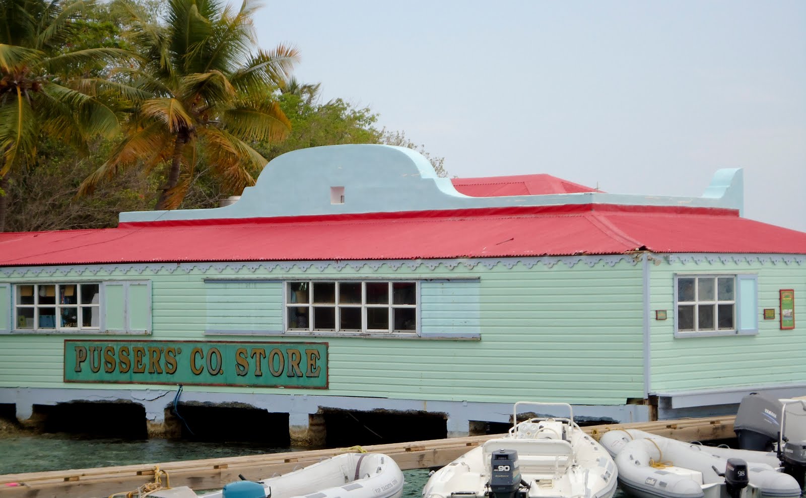 We wanted to go and look at Pusser’s store over at Marina Cay, and didn’t feel like a trip across the channel in the dinghy. So we called over there and found out there was a free shuttle. We took the shuttle over and looked around the store and the island. We also asked about mooring there, but they had all been taken. Pusser’s store had a good selection of souvenirs, most of which were pirate-themed or nautically-themed. Pusser’s is right next to the fuel dock and Marina Cay mooring field.
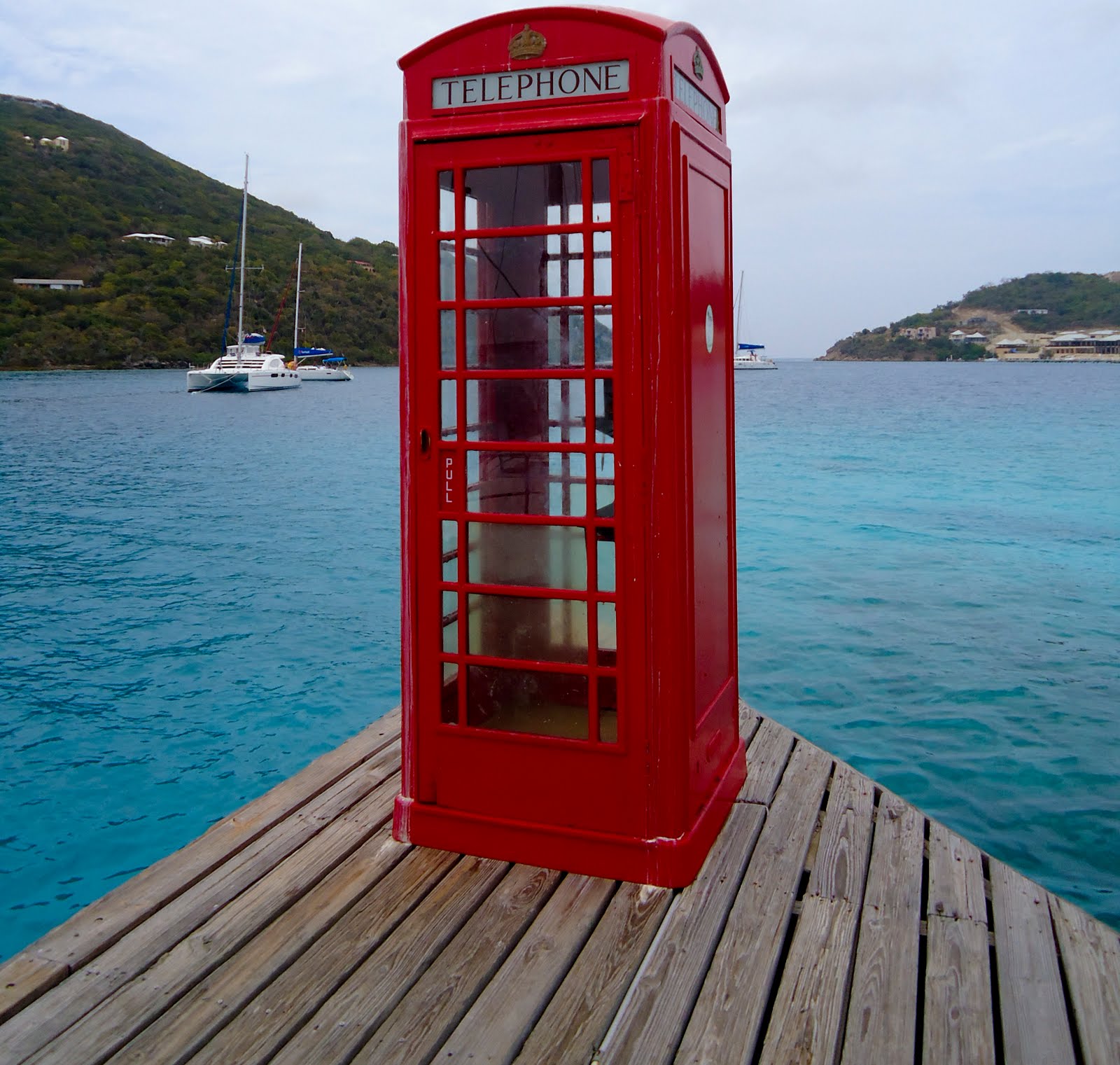 Marina cay is a nice stop. There’s snorkeling south of the cay, and full services on the island (fuel, water, ice, laundry, restaurants). There’s also a telephone booth on the fuel dock with a webcam that snaps a picture every 15 seconds. If you go online to Pusser’s website, you can see the pictures taken. You can also call home from the phone booth, and let them see you standing there while you talk.